Is your ideal day stepping from your backyard dock and cruising straight to the Gulf for a sunset run? On Anna Maria Island, that vision is real, but each canal, bridge, and pass tells a different story. If you understand depths, tides, air clearance, and local rules, you can match the right home to your boat and boating style. This guide breaks down how access really works on Anna Maria, what to verify before you buy, and the steps that keep your trips smooth and safe. Let’s dive in.
AMI waterways and Gulf routes
Anna Maria Island sits between the Gulf of Mexico and the bay system often called Anna Maria Sound, part of the Sarasota Bay and Tampa Bay complex. Most canal homes open to the bay side, not directly to the Gulf. Your typical route is canal to a local channel, then into the bay, and finally through passes like Longboat Pass or the Tampa Bay entrance to reach the Gulf.
Passes shift with weather and tides. Markers can move and depths can change. Always plan with authoritative resources such as the NOAA nautical charts and check recent U.S. Coast Guard Local Notices to Mariners for updates to aids to navigation.
Canal depths and tides
Residential canals on Anna Maria are man‑made or dredged and vary widely in width and depth. Shoaling at canal mouths is common. Typical shallow-water depths in similar Gulf barrier‑island canals range from a few feet to 6–8 feet at mean low water, but local conditions may be shallower.
Tide stage matters. The local tidal range often swings 1 to 3 feet between spring and neap tides, which can make the difference for a boat with deeper draft. Check the nearest station using NOAA Tides & Currents and treat charted depths as references, not guarantees. For any property you are serious about, measure depth at the seawall at mean low water or hire a marine surveyor to perform soundings.
Bridges and air draft
Your route from canal to bay to Gulf may include one or more bridge transits. If your vessel has a t‑top, antennas, towers, or a mast, confirm your air draft against the lowest span on your intended route. Vertical clearance can vary by bridge and tide.
Published clearances and any changes appear in official sources. Verify using NOAA charts and review the Local Notices to Mariners for current operations, restrictions, or maintenance that may affect openings or marked channels.
Pass hazards and currents
Gulf passes in this area are dynamic. Expect shifting sandbars, cross currents at mid to low water, and strong flow in narrow cuts. Nearshore, you will find shallow flats and occasional unmarked obstructions, especially after storms.
Stay in marked channels, keep a conservative speed, and follow posted rules. Manatee protection zones and slow‑speed areas are active in Southwest Florida. Review maps and guidance from the Florida Fish and Wildlife Conservation Commission before your first run of the season.
Ramps and marina services
If you are trailering or meeting contractors, you can locate public ramps through the BoatUS national launch database. Larger marinas in the Bradenton and Sarasota corridor typically offer fuel, pump‑outs, transient dockage, and repairs. In peak winter season, slip and service availability is tighter, so plan ahead and reserve early.
When vetting a property, map the route from the home’s canal to the nearest fuel dock and haul‑out facility. This helps you understand not just access to the Gulf, but also routine service logistics.
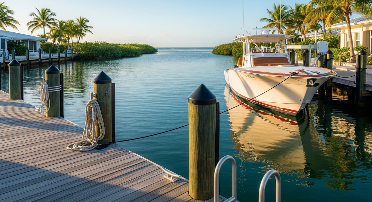
Docks, lifts, and permits
Dock, lift, and seawall projects often require approvals from multiple agencies. In most cases you will work with the city or county permit office for local code compliance, the Florida Department of Environmental Protection for work seaward of mean high water, and sometimes the U.S. Army Corps of Engineers for dredging or structures in navigable waters.
Start with the county for local rules and records, then confirm state and federal requirements:
- Local permits and records: Manatee County official site
- Coastal and environmental permits: Florida DEP coastal programs
- Federal regulatory guidance: U.S. Army Corps of Engineers, Jacksonville District
As part of due diligence, request copies of any existing dock, lift, or seawall permits and recent repair records. If a canal requires periodic dredging, ask for the neighborhood’s dredging history and whether future assessments are expected.
Seasonal conditions to watch
Red tide events can affect air quality, fishing, and comfort on the water. Before planning longer runs, review current conditions from Mote Marine Laboratory. Hurricane season runs June through November, so confirm your vessel’s storm plan and storage options early.
Winter brings higher boating traffic and more transients, so expect increased congestion in popular channels and at fuel docks. During busy periods, longer no‑wake transits add time to your runs, which can be a factor when choosing a canal home.
Buyer’s waterfront checklist
Use this quick list to match a property to your boat and boating style:
Vessel compatibility
- Measured depth at the seawall at mean low water for your draft.
- Channel depth from the property to the marked channel, and from there to the bay and passes.
- Air draft clearance for bridges and powerlines on your intended route.
- Turning room in the canal for your length and beam.
Dock and shore infrastructure
- Seawall or bulkhead condition and any inspection reports.
- Dock type and condition, plus available electrical service and breaker capacity.
- Existing boat lift capacity, age, and service records.
- Riparian rights, dock easements, and any HOA rules.
Permits and maintenance
- Copies of dock, lift, and seawall permits and any open violations.
- Canal or neighborhood dredging history and potential assessments.
- Whether submerged land leases or special approvals apply.
Costs and risk
- Insurance availability for waterfront property and your vessel.
- Expected maintenance for dock, lift, seawall, and periodic dredging.
Local knowledge
- Confirm charted depths with on‑site soundings.
- Review NOAA nautical charts and NOAA Tides & Currents.
- Check the latest Local Notices to Mariners and FWC rules.
Choose the right canal home
The best Anna Maria canal homes pair everyday convenience with the routes you love to run, whether that is a quick Gulf hop through Longboat Pass or a relaxed day exploring the bay. A careful look at depths, tides, bridges, and permits up front protects your time and your investment. With a clear plan, your dock can be a true launchpad for the island lifestyle.
If you want a discreet, concierge search focused on boating access, local insight, and a smooth transaction, reach out to Kathy Harman. Discuss your island priorities and let’s find the perfect waterfront fit.
FAQs
How do you reach the Gulf from an Anna Maria canal home?
- You typically run from your canal to a local channel, into the bay system, then through a marked pass like Longboat Pass or the Tampa Bay entrance. Conditions change, so verify your route with current charts and local guidance.
What boat sizes work best in Anna Maria canals?
- Many residents favor shallow‑draft center consoles, bay boats, and skiffs, since canal depths and shoaling vary. Measure depth at mean low water for any property and compare to your boat’s draft before you buy.
Are there speed limits or manatee zones near Anna Maria Island?
- Yes. Slow‑speed and protection zones apply in parts of the bay and channels. Always follow posted signs and review official manatee and boating rules before operating.
What should you check before docking a tall boat with a tower?
- Confirm the lowest bridge clearance on your entire route at the expected tide, and make sure your vessel’s air draft clears with margin. Also check for powerlines or fixed spans within canals.
Where can you find public boat ramps near Anna Maria?
- Use a national ramp locator to identify nearby public ramps, then confirm hours, fees, and trailer parking before you go. During peak season, arrive early or consider weekday launches.
Do you need permits to add a lift or expand a dock?
- Most projects require local permits, and some trigger state or federal review. Collect existing permits and consult the county early in your planning to avoid delays.