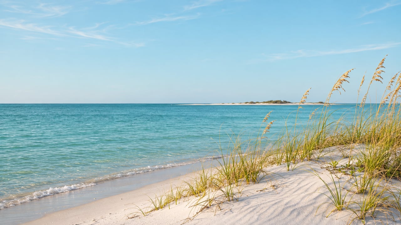
Bean Point is named for a homesteader whose 1893 claim ran from the island's north tip south to Magnolia Avenue. In late October, Anna Maria commissioners spent part of two meetings discussing whether a county trolley could loop out to the point. A sheriff's deputy had told Commissioner Gary McMullen that most people who want to watch the sunset in Anna Maria want to watch it there, according to the Anna Maria Island Sun.
The crowds see a beach and a strip of sand offshore. That strip is Passage Key. A hurricane took it off the map in 1921 and it has slowly come back since. The dunes behind the beach were replanted by hand less than two years ago. Passage Key's story is on a state historical marker in Bayfront Park, around the corner on North Bay Boulevard.
The marker in Bayfront Park
The State of Florida's marker titled "Passage Key - Gateway to Historic Tampa Bay" went up in 1975 and stands on North Bay Boulevard in Bayfront Park. Its text begins by placing Passage Key "less than a mile to the north," marking the southern entrance to Tampa Bay. The island across the inlet from Bean Point has carried four other names, and the marker records each one:
- Isla de San Francisco y Leon, from the Spanish in 1757
- Burnaby Island, from the English in 1765
- Pollux Key, paired with "Castor Key" for nearby Egmont Key
- Cayo del Paseje, from 1783, which became today's Passage Key
According to the marker, the key was once much larger. It had a freshwater lake ringed by large trees, probably fed by a spring, and passing ships stopped there for water. In the early 1830s a Baltimore sea captain, William Bunce, ran a fishing "rancho" on the island.
President Theodore Roosevelt designated Passage Key a migratory bird refuge in 1905. Its warden for the next stretch of years was Captain Asa N. Pillsbury Jr. of the National Audubon Society, who in 1910 recorded 102 bird species on the island. He was still the warden on the night of Oct. 25-26, 1921, when, in the marker's words, the island "disappeared under a hurricane-spawned tidal wave." The marker's text closes by noting that the key "has gradually re-emerged" and is again a seabird sanctuary.
So the low shape across the inlet at sunset is an island that was gone within the lifetimes of the island's first families and has been rebuilding grain by grain ever since.
What the key is now
Passage Key National Wildlife Refuge sits at the mouth of Tampa Bay, south of Egmont Key. The U.S. Fish and Wildlife Service describes it as a shifting sandbar that is closed to public use all year. It is nesting, resting and wintering habitat for migratory birds, and the agency says more than 50 bird species have used it.
The key keeps changing shape. In a May 2024 fishing column, the Anna Maria Island Sun described Passage Key as a sandbar that was building back.
The dunes under the sunset crowd were planted in January 2025
The ground at Bean Point has been rebuilt too. After the 2024 hurricanes, more than 300 volunteers with Build Back the Beach planted nearly 30,000 native plants along the Anna Maria shoreline between Bean Point and Sycamore Avenue, the Sun reported. The work ran in three shifts over the weekend of Jan. 25 and 26, 2025.
The effort was started and organized by Cindy and Tryn Stimart, part-time Anna Maria residents who also live in Lakewood Ranch. Damon Moore, executive director of Oyster River Ecology, contributed his plant knowledge and technical expertise. The plants cost nearly $30,000, and the Stimarts pledged to match half of the donations needed to pay for them.
The species are easy to spot on a walk along that stretch: sea oats, panic grass, railroad vine, also called morning glory, and dune sunflowers. Volunteers set them about a foot apart. They drilled holes in the sand with a battery-powered auger and filled each one with plant gel before the plant went in. Dawn Zimmerman, owner of Bradenton-based Filters Done Right, helped dig holes that Saturday. She told the Sun she had been coming to the island since she was 21 and that the planting was "the least I can do to give back to such a beautiful place where I've made so many memories."
The signs at the four North Shore Drive entries
The water off the point has its own history at City Hall. In September 2025, the city replaced its "No Swimming, Dangerous Currents" signs at Bean Point with new ones that read "Warning. Dangerous Currents. Swim at Your Own Risk. No Lifeguards." Public works crews put them along the shoreline on Sept. 25 and at four beach access entries along North Shore Drive the next day, the Sun reported.
The new signs followed Mayor Mark Short's Sept. 15, 2025 veto of an emergency ordinance that would have formalized a no-swim zone running east from the Fern Street beach access to the access between 831 and 833 North Shore Drive. All five commissioners backed the veto at their Sept. 25 meeting. Short's comment to the Sun on the signs was direct: "If they choose to swim there that's fine, but they can't say they weren't warned."
People of every age still wade and swim at the point. McMullen said the mayor's decision let Bean Point homeowners and others keep swimming there while making them aware of the risks.
A trolley loop across George Bean's old homestead
The newest Bean Point question is how people get there, and it covers ground George Emerson Bean once homesteaded. The Anna Maria Island Chamber's history says Bean's claim ran from the North Point to Magnolia Avenue. His son, George Wilhelm Bean, and his associates formed the Anna Maria Beach Development Company in 1911 and built the resort's first streets. The city incorporated in 1923.
Magnolia Avenue is now part of the Free Island Trolley's route. Within roughly the past year the trolleys were rerouted down Magnolia, past The Center of Anna Maria Island, and on to South Bay Boulevard, where a temporary stop near the City Pier went in this March. At the Oct. 22 commission meeting, McMullen asked whether the trolley could "go around to Bean Point and come back on North Shore to Pine." He said the loop could help with concerns about how little public parking there is in the residential streets near the point. "Everybody's concerned about getting to Bean Point," he said.
The idea came up again at the Oct. 27 joint meeting of the commission and the Planning and Zoning Board, and that discussion turned on details north-end residents know well. Planning and Zoning Board Chair Jeff Rodencal asked whether the humpback bridge on North Bay Boulevard could carry vehicles that size several times a day, and Short said it could. Rodencal also pointed out that pedestrians often walk North Shore Drive as if it were a path rather than a street, and that the street has speed bumps. One suggestion was for the trolley to return from the point on North Bay Boulevard and turn right onto Pine Avenue. Commissioner Chris Arendt said that version of the loop would also keep the trolley on Pine Avenue for the businesses there. A possible trolley stop at Bayfront Park, home of the Passage Key marker, was also mentioned briefly.
Short said the obstacle is capacity, not interest. County officials have told him the island trolleys carry the highest ridership in the countywide MCAT system, and that the limit is the number of qualified drivers. As of the Sun's Nov. 10 report, Short had opened early conversations with the county and no rerouting was pending.
The trolley talk runs alongside the city's broader parking program. In early November that program was still a proposal, with concepts that included resident permit parking, paid parking near some beach accesses, free timed parking in the business district and employee parking, as the Sun reported on Nov. 5. Our earlier post on Anna Maria's draft parking plan covers what it would mean for residents' own cars, and our guide to getting around Anna Maria without a car covers the trolley as it runs now.
For anyone who already walks or bikes to the point, the full circuit is short: North Shore Drive to the beach, then around to Bayfront Park on North Bay Boulevard. On that one loop you can see the replanted dunes, the signs at the North Shore Drive entries, the marker that tells Passage Key's story and the key itself.
If you're weighing a home within walking distance of Bean Point, or wondering how a trolley loop or a parking program might change a particular street, Kathy Harman is happy to talk through your island priorities and help you find the right waterfront fit.